How To
Using Disturbance Severity
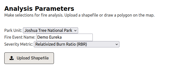
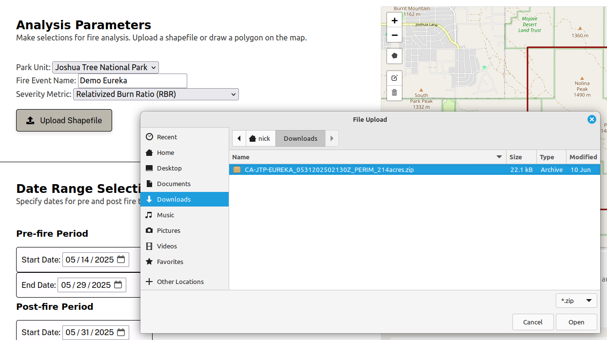
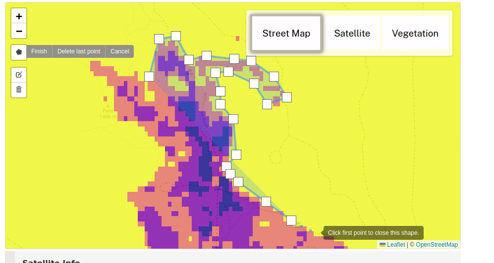
Begin by visiting the Disturbance Severity tool. There are two routes you can take to analyze a fire event: one where you upload a shapefile defining a fire boundary, and another where you draw an approximate boundary on the map.
In either case, you will provide the following information:
Park Unit
Select the park unit where the fire event occurred. Currently, Joshua Tree National Park and Mojave National Preserve are supported.
Fire Event Name
A unique name for this particular fire event.
Severity Metric
The fire severity metric to use for analysis. Three options are available:
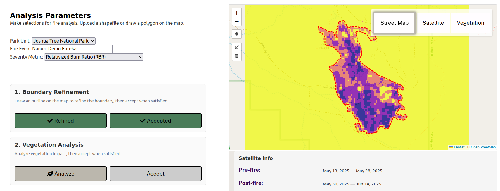
Relativized Burn Ratio (RBR) - Recommended for low-biomass environments like the Mojave Desert. RBR normalizes severity relative to pre-fire vegetation, so a fire that completely consumes sparse desert vegetation registers as high severity even though the absolute change is small.
Relativized differenced NBR (RdNBR) - Similar to RBR but uses a different normalization approach. Useful for comparison with some federal severity products.
differenced NBR (dNBR) - Measures absolute change in vegetation reflectance. Best suited for high-biomass environments like forests. In low-biomass areas, dNBR may underestimate severity because there is less vegetation to lose.
See Methodology for technical details on how these metrics are calculated.
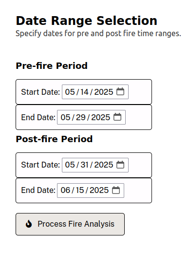
Date Ranges
Pre-fire and post-fire date ranges to collect imagery. We recommend 2-3 week windows before and after the fire event. Wider windows include more satellite passes but may introduce phenological bias.